


All Architecture Illustration Expert 3D Architectural Illustration Services
At All Architecture Illustration, (A division of GeoShot Technologies), we bring concepts to life through powerful and engaging visual storytelling. Our detailed architectural illustrations are designed to communicate complex ideas with clarity and artistry.
In today's fast-paced design and development world, visuals play a pivotal role in turning ideas into reality. Whether you're showcasing a residential building, planning an urban space, or mapping out a large real estate project, having clear, compelling visuals is essential. That's where our specialized 3D architectural illustration services come in.
Read More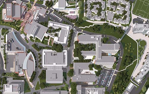
Why 3D Architectural Illustration is a Game-Changer
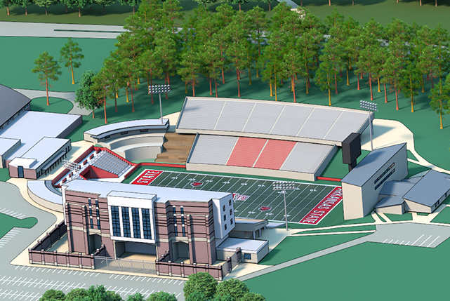
A 3D architectural illustration does more than just depict a structure it offers a lifelike representation of spaces before they are even built. These visuals allow architects, developers, investors, and the public to understand the scale, layout, and aesthetics of a project long before ground is broken.
Our illustrations combine technical accuracy with artistic vision. Whether you're designing a master-planned community, a single home, or a tourism map, our 3D visuals help you connect with your audience on both practical and emotional levels.
Standing Out Among Architectural Rendering Companies
While many architectural rendering companies focus solely on basic 3D renderings, we go a step further. At All Architecture Illustration, we blend creativity, design sensibility, and advanced modeling techniques to craft visuals that tell a story. We specialize in more than just buildings. From 2D and 3D map illustrations to photorealistic renderings and urban masterplans, our diverse range of services ensures that all aspects of your project are visualized with consistency and style. We ve earned a reputation among top architectural rendering companies for our fast turnaround, attention to detail, and the ability to tailor each illustration to suit client goals and branding.
Services
We provide an end-to-end illustration service that covers everything from conceptual sketches to finalized renderings. Our core services include:
Each project is created with precision to help our clients communicate their vision effectively to stakeholders, planners or customers.
Our Satisfied Clients
Let Visualize Your Next Project Together
Whether you're launching a new construction project, presenting to stakeholders, or enhancing a marketing campaign, our illustrations help your vision shine. Our team is here to turn your ideas into striking visuals that capture attention and drive results.